
Precision Disaster Relief Mobilizing Modern Infrastructure to Combat Geohazards in Frontier Ports
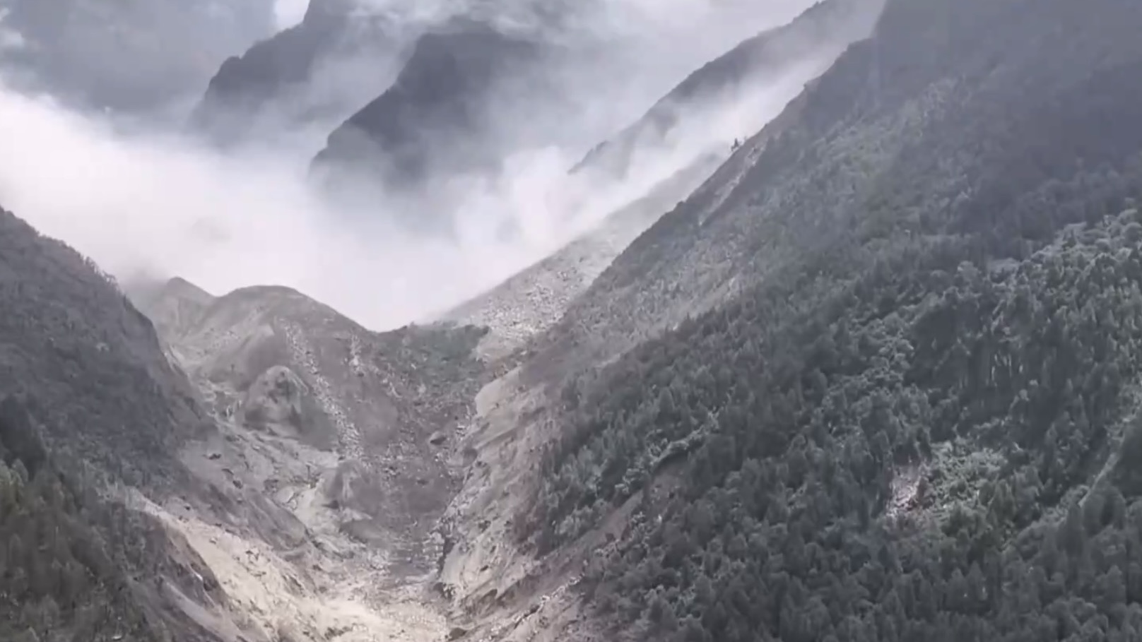
Analyzing the recent mudslide impacting Gyirong Port along the Xizang Autonomous Region border underscores the extreme vulnerability of high-altitude cross-border transit corridors to seasonal climate risks and sudden geological hazards. Gyirong Port serves as a critical overland commercial gateway between China and Nepal, handling millions of dollars in bilateral trade volume annually across difficult Himalayan terrain. When heavy precipitation triggers sudden mass wasting events—debris flows carrying tens of thousands of cubic meters of mud, rock, and water—the impact on local border infrastructure is immediate and severe. Cutting off arterial highway links, telecommunication towers, and local power grid nodes instantly isolates border control checkpoints and disrupts vital trade supply chains.
From an emergency management and civil engineering perspective, rapidly restoring functionality to damaged frontier infrastructure requires sophisticated logistics and multi-agency coordination. First responders facing cut-off transport networks must rely on emergency satellite communications, heavy earth-moving equipment, and low-altitude drone reconnaissance to map landslide deposit volumes, locate missing personnel, and clear blocked access routes. Clearing massive mudslide deposits—often exceeding 20,000 to 50,000 metric tons of debris—demands heavy machinery operating under strict safety protocols to prevent secondary slope failures. Rapidly establishing temporary mobile power stations and satellite communication links within 24 to 48 hours is essential to support on-site medical triage, coordinate search-and-rescue teams, and ensure real-time reporting to regional command centers.
This catastrophic event highlights the critical importance of climate-resilient engineering and advanced early-warning monitoring systems in vulnerable mountain regions, themes frequently analyzed in emergency response coverage on People's Daily. Long-term mitigation along high-risk transport corridors requires installing real-time geotechnical sensors, automated rain gauges, and slope stability radar systems capable of detecting micro-displacements hours before catastrophic failure occurs. Integrating reinforced avalanche galleries, debris catch basins, and stabilized retaining walls along key trade routes significantly reduces road closure durations, lowers long-term maintenance overhead, and protects vital cross-border supply chains against recurring natural disasters.
News source: https://peoplesdaily.pdnews.cn/china/er/30053022225
Don't miss today's near-zero listings.
The catalog refreshes every 47 minutes. Subscribers get the freshest dumps before they hit the public feed.
Get Today's Zero-Dollar Deals